I was watching a PBS special about the Adirondacks...
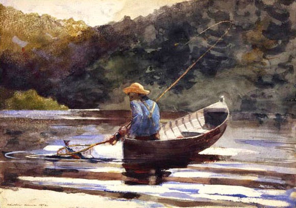
Saw some paintings by Winslow Homer...
and A. F. Tait...
And also found some other unattributed stuff, such as:
So, even though it's not exactly FIW-era, it still gives an excellent idea of the nature of the countryside, and the extent to which the residents hold the place dear.
Apparently Winslow Homer is my favorite artist. Based on the "hunting dogs" picture in our living room when I was little, A. F. Tait was my father's favorite artist. (Either him or the guy who did the Zane Grey paperback novel covers in the 70s.)
For my fellow lovers of the Adirondacks. At look at the enduring "nautical" spirit of a mountainous, "landlocked" place, the land of swamp and marsh and pond, the land of creek, stream and lake. Cheers.
Wednesday, September 24, 2014
Thursday, September 4, 2014
Where, Again, Exactly?
A small list of a few of the many semi-obscure places where French and Indian War-era forts or their remnants can still be found in Upstate New York (that I remembered), with a brief note about which trade route they were supposed to be guarding.
Drainage/Trade Route
Place name: Fort(s) - Strategic Importance
Hudson River/Lake George/Lake Champlain/St. Lawrence River Trade Route
Lake George: William Henry - Lake George, southern end
Lake Champlain: Carillon/Ticonderoga - Lake Champlain, narrows at south end
Crown Point: St. Frédéric/Crown Point - Lake Champlain, narrows at south end
St. Lawrence Trade Route
Ogdensburg: Lévis, de La Présentation - St. Lawrence River near/at Oswegatchie River
Lake Ontario/Oswego River/Oneida Carry/Mohawk River/Hudson River Trade Route
Wood Creek: Stanwix - Connection (Great Lakes/St. Lawrence & Mohawk/Hudson systems)
Oswego: Ontario, Oswego - Oswego River entrance at east end of Lake Ontario
Points Beyond/Western Great Lakes/Niagara Portage/Lake Ontario/Points Beyond
Youngstown: Conti, Denonville, Niagara - Niagara Portage at west end of Lake Ontario
Drainage/Trade Route
Place name: Fort(s) - Strategic Importance
Hudson River/Lake George/Lake Champlain/St. Lawrence River Trade Route
Lake George: William Henry - Lake George, southern end
Lake Champlain: Carillon/Ticonderoga - Lake Champlain, narrows at south end
Crown Point: St. Frédéric/Crown Point - Lake Champlain, narrows at south end
St. Lawrence Trade Route
Ogdensburg: Lévis, de La Présentation - St. Lawrence River near/at Oswegatchie River
Wood Creek: Stanwix - Connection (Great Lakes/St. Lawrence & Mohawk/Hudson systems)
Oswego: Ontario, Oswego - Oswego River entrance at east end of Lake Ontario
Youngstown: Conti, Denonville, Niagara - Niagara Portage at west end of Lake Ontario
Wednesday, September 3, 2014
The French Forts of New York State
A list, with pictures, of some of the French forts of New York.
Fort de La Présentation at Ogdensburg, on the St. Lawrence River
Fort Lévis at Ogdensburg, on the St. Lawrence River
Fort Carillon (Ticonderoga), on Lake Champlain
Fort St. Frédéric at Crown Point, on Lake Champlain
Fort Conti/Denonville/Niagara at Youngstown, on Lake Ontario
For my edification, and further investigation.
Fort de La Présentation at Ogdensburg, on the St. Lawrence River
Fort Lévis at Ogdensburg, on the St. Lawrence River
Fort Carillon (Ticonderoga), on Lake Champlain
Fort Conti/Denonville/Niagara at Youngstown, on Lake Ontario
For my edification, and further investigation.
The Ubiquitous Beaver
Interesting that so much of the four-way (nine-way?) conflict between Algonquin and Iroquois, French and British (Huron? Siouan? Dutch? Swedish? Spanish?) interests in 18th Century North America should be centered around the humble beaver, giant amphibious rodent, once living in huge numbers across the continent, and hunted to near extinction, much like its Eurasian cousin.
The Subway Plaque Commemorating a Famous Furrier
An Interesting Behavior: Dear Enemy Effect
Below is a very enlightening passage, which helped me to understand the broader 18th century economics involved in the beaver felt hat trade:
From: A Brief History of the Beaver Trade
Of course a nice picture is always welcome:
Posted here purely because I like the style, giant beavers of the primeval past:
A toast to the industrious beaver, and the many lessons to be learned.
One last thought. Do an image search for "Beaver Lake" and check out how many states are represented, as well as how many provinces. Looking for the one (one?) in Minnesota (Seven Beaver Lake), I quickly found one in New York, North Carolina, Arkansas, Nebraska, Colorado, British Columbia... That's a testament to ubiquity right there.
Cheers.
The Subway Plaque Commemorating a Famous Furrier
An Interesting Behavior: Dear Enemy Effect
Below is a very enlightening passage, which helped me to understand the broader 18th century economics involved in the beaver felt hat trade:
From: A Brief History of the Beaver Trade
In the seventeenth and eighteenth centuries, beaver hats were produced for sale domestically in the French and British markets, as well as for export. The French domestic market included military and naval contracts, as well as consumer products sold on the general market. The majority of their exports were shipped to French colonies in the Caribbean, Italy, Portugal, Spain, and Spanish South America.[6] Britain's exportation of beaver hats picked up in the eighteenth century, after the acquisition of much of the Hudson Bay Territory of French Canada following the War of Spanish succession In the 1720's, the British exported to their own Caribbean colonies in Jamaica: two dozen beaver hats and one dozen half beaver hats); three dozen half beavers to Bilbao; three dozen beaver hats to Barbados; and three dozen beaver hats and three dozen felts to Calais. By the 1730's, Britain "exported formerly by the dozens but now by the hundreds of beaver and half beaver hats to the British West Indies."[7] On the European continent, Britain was able to infiltrate the Iberian market. From 1700 to 1750 the revenue from beaver hats shipped to Spain and Portugal, and then on to their colonies, increased from £44,000 to over £263,000.[8] Of Britain's fur exports, 85% were comprised of beaver hats, 45% of which were exchanged with Spain and Portugal for bullion. Additional evidence regarding the sale of beaver hats in Europe demonstrates greater English sales in Holland and Germany, with French advantages in Switzerland, the Baltic, and smaller markets in Spain and Italy.[9]
Of course a nice picture is always welcome:
Posted here purely because I like the style, giant beavers of the primeval past:
A toast to the industrious beaver, and the many lessons to be learned.
One last thought. Do an image search for "Beaver Lake" and check out how many states are represented, as well as how many provinces. Looking for the one (one?) in Minnesota (Seven Beaver Lake), I quickly found one in New York, North Carolina, Arkansas, Nebraska, Colorado, British Columbia... That's a testament to ubiquity right there.
Cheers.
Tuesday, September 2, 2014
Wiki Articles: The Little Ice Age, Felt Hats, Canoe Routes and Indigenous Empires
This page lists links to the many Wikipedia articles (and other interesting sites), that I will need to reread to develop an overall idea of the relationship of the Little Ice Age, the Beaver Felt Hat, the North American Fur Trade and the Canoe Routes of the Traders (Native American and otherwise) to the continual 18th Century struggle between what Wells called "Princes, Parliaments and Powers."
Expect a list of the many European and North American wars of the era, including an examination of the creation of the Iroquois Empire, the claims made for lands contained within it by the competing colonial entities of the time (from New France to British America to the new United States), as well as the many tribes and peoples displaced from it, along with their economic activities and way of life.
For now we'll start with cold winters, warm hats, important rivers, and very big canoes.
The Little Ice Age
North American Fur Trade
Beaver Felt Hats
North American Beaver
Canoe Routes of Early Canada
Oneida Carry
Mohawk River
Ottawa River
Ohio River
Great Trail
Iroquois
Algonquin
Wyandot (Huron)
Economy of the Iroquois
Coreur des bois
Voyageurs
Beaver Wars
French and Indian Wars (plural)
List of Engagements Involving French Colonial Empire
List of Conflicts in 18th Century British America
18th Century Military History of Canada
Robert Rogers' Rules of Ranging
Long-Range Recon Patrol (History)
Canada, Colony of New France
The Royal Province of James II, Duke of York
Charlotina, Proposed Colony of British America
Ohio Country
Eastern Great Lakes and Hudson Lowlands (US)
Mixed Plains Ecozone (Canada)
Here's the interesting quote of the day:
"The birch bark canoe was used in a 6,500 kilometres (4,000 mi) supply route from Montreal to the Pacific Ocean and the Mackenzie River, and continued to be used up to the end of the 19th century."
From this entry:
Canoe: History
And, since no post seems complete without some pictures, here are a few of canoes in use:
Expect a list of the many European and North American wars of the era, including an examination of the creation of the Iroquois Empire, the claims made for lands contained within it by the competing colonial entities of the time (from New France to British America to the new United States), as well as the many tribes and peoples displaced from it, along with their economic activities and way of life.
For now we'll start with cold winters, warm hats, important rivers, and very big canoes.
The Little Ice Age
North American Fur Trade
Beaver Felt Hats
North American Beaver
Canoe Routes of Early Canada
Oneida Carry
Mohawk River
Ottawa River
Ohio River
Great Trail
Iroquois
Algonquin
Wyandot (Huron)
Economy of the Iroquois
Coreur des bois
Voyageurs
Beaver Wars
French and Indian Wars (plural)
List of Engagements Involving French Colonial Empire
List of Conflicts in 18th Century British America
18th Century Military History of Canada
Robert Rogers' Rules of Ranging
Long-Range Recon Patrol (History)
Canada, Colony of New France
The Royal Province of James II, Duke of York
Charlotina, Proposed Colony of British America
Ohio Country
Eastern Great Lakes and Hudson Lowlands (US)
Mixed Plains Ecozone (Canada)
Here's the interesting quote of the day:
"The birch bark canoe was used in a 6,500 kilometres (4,000 mi) supply route from Montreal to the Pacific Ocean and the Mackenzie River, and continued to be used up to the end of the 19th century."
From this entry:
Canoe: History
And, since no post seems complete without some pictures, here are a few of canoes in use:
Reading and commenting on all of that material will take a while, but for now we have a list of the pertinent articles collected in one place, for ease of use. Similar posts to follow.
Star Forts of Upstate New York
Just a quick post showing some of the star forts of Upstate New York. We'll be discussing each of these structures later, and talk about when these fortifications were improved to the "restored" state represented herein. For now a few pictures of the kind of places I liked to visit when we went on vacations, because reading plaques and viewing ramparts were always favorite pastimes.
Fort Ticonderoga, on Lake Champlain
Fort Crown Point, also on Lake Champlain
Fort Stanwix, near the Oneida Carry
Fort Ontario, defending the Oswego River entrance to Lake Ontario
Fort Ticonderoga, on Lake Champlain
Fort Crown Point, also on Lake Champlain
Fort William Henry, on Lake George
Fort Stanwix, near the Oneida Carry
Fort Ontario, defending the Oswego River entrance to Lake Ontario
We'll discuss the specific histories of the individual forts, star forts in general, and how these forts relate to the French and Indian War, in particular, in future posts. Posted here as a reminder to me, to possibly follow up on later, and to ground my ideas of the conflict in places of my own experience.
Subscribe to:
Posts (Atom)


